
Field investigations conducted within the PR16220 Bonjunju exploration permit, Wamba Territory, documented several geological and structural features that are fundamental to understanding the area’s gold mineralization. The observations presented below summarize the main lithological, structural, and weathering characteristics identified during the field campaign.
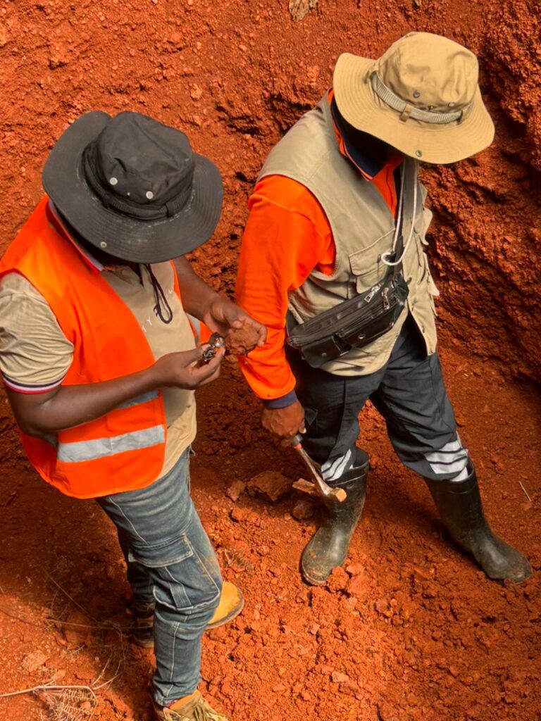
The 3.2 m deep artisanal well reveals two main horizons. At the surface, the colluvium consists of reworked materials with potential for alluvial and eluvial gold concentrations.
At depth, the red lateritic horizon is characterized by strong oxidation, silica leaching, and enrichment in iron and aluminum oxides. It results from the weathering of greenstones and BIFs (Bio-Intrusion Factors) of the Uélé Greenstone Belt basement.
This weathering thickness reflects a long period of tectonic stability under a tropical climate, favorable to supergene processes. The laterites thus constitute effective traps for fine gold resulting from the erosion of the bedrock composed of intrusions and metasediments. They therefore represent a major exploration target before reaching undisturbed bedrock (Intrusion or Meta-Sediment).
Lateritic Profile Observed in an Artisanal Pit
A 3.2 m deep artisanal pit exposed a well-developed lateritic profile consisting of two distinct weathering horizons.
The upper horizon is composed of colluvial materials derived from the reworking and downslope transport of weathered rocks. These sediments constitute a favorable environment for the concentration of alluvial and eluvial gold, making them an important exploration target.
The lower horizon consists of a red lateritic layer characterized by intense oxidation, extensive silica leaching, and enrichment in iron and aluminum oxides. This horizon developed through prolonged weathering of the greenstone and Banded Iron Formation (BIF) units that form part of the Uélé Greenstone Belt basement.
The significant thickness of the weathering profile reflects long-term tectonic stability under tropical climatic conditions, which promoted intense supergene processes. As a result, the laterite acts as an effective geochemical trap for fine gold released during the weathering of the underlying intrusive and metasedimentary bedrock. Consequently, these lateritic horizons represent priority exploration targets before reaching fresh bedrock.
Figure X. Lateritic profile exposed in a 3.2 m deep artisanal pit, illustrating the main weathering horizons.
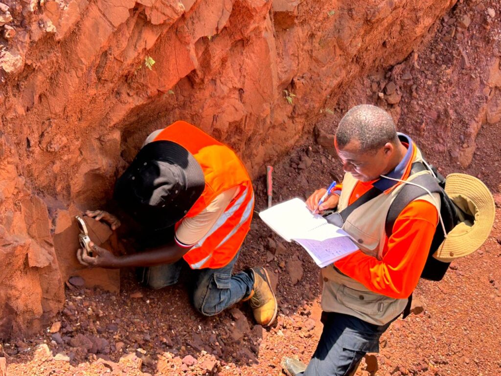
Measurement of foliation (Strike and Dip) in metasedimentary rocks and recording of structural data – Structural mapping work, Permit PR16220 Bonjunju, Wamba.
The rocks exhibit strong surface oxidation due to weathering, but the schistosity remains well expressed. These measurements are essential for understanding the deformation and structural control of gold mineralization in the Greenstone Belt, primarily in the Bonjunju Concession.
Foliation Measurements and Structural Data Acquisition
Structural mapping carried out within the PR16220 Bonjunju permit included systematic measurements of foliation orientation (strike and dip) in metasedimentary rocks to characterize the structural framework of the area.
Although the outcrops exhibit intense surface oxidation due to tropical weathering, the schistosity remains clearly preserved, allowing reliable structural measurements to be collected. These data are essential for reconstructing the deformation history and identifying structural controls on hydrothermal fluid flow.
The structural measurements contribute to a better understanding of the deformation patterns controlling gold mineralization within the Uélé Greenstone Belt, particularly across the Bonjunju concession.
Figure X. Measurement of foliation (strike and dip) in metasedimentary rocks during structural mapping activities.
Structural Mapping of Iron-Rich Quartz Veins
Field mapping also identified iron-rich quartz veins intercalated within metasedimentary lithologies. These veins are spatially associated with shear zones, which constitute the principal structural controls on gold mineralization.
The occurrence of banded quartz veinlets within the Banded Iron Formation (BIF) indicates hydrothermal fluid circulation along structural discontinuities. Shear zones provided favorable pathways for fluid migration, fracture development, and subsequent gold deposition, making them high-priority exploration targets.
The detailed characterization of these quartz veins and their relationship with the host metasedimentary rocks provides valuable insight into the mechanisms of gold mineralization and supports future exploration activities within the Bonjunju permit.
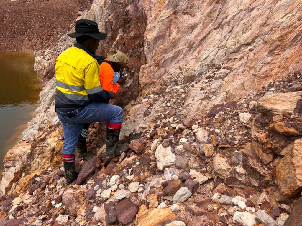
Structural mapping: Iron-rich quartz veins intercalated with metasedimentary lithologies. Shear-zone hosted gold mineralization within Banded veinlets of Iron Formation
Figure X. Iron-rich quartz veins intercalated with metasedimentary rocks, illustrating shear zone-hosted gold mineralization within banded iron formations.
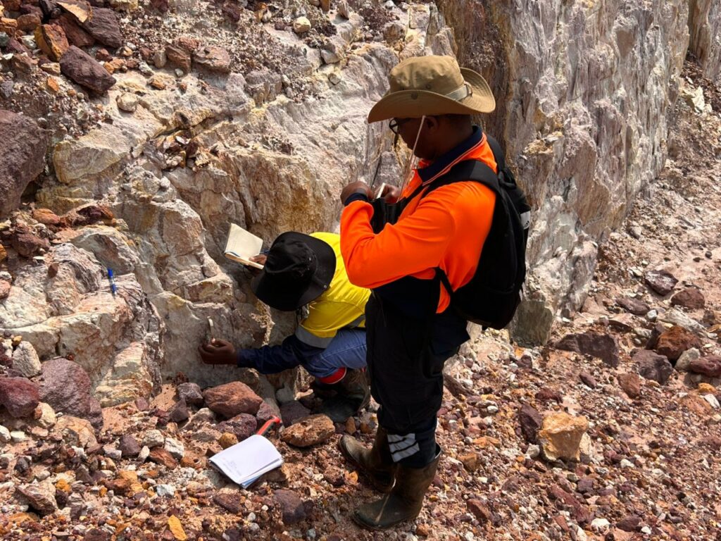
Structurale mapping _ foliation Strike and dip measurement
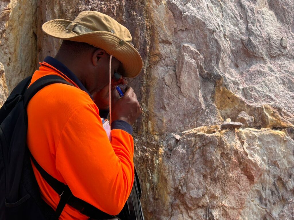
Minerals indetification @Bonjunju Prospect
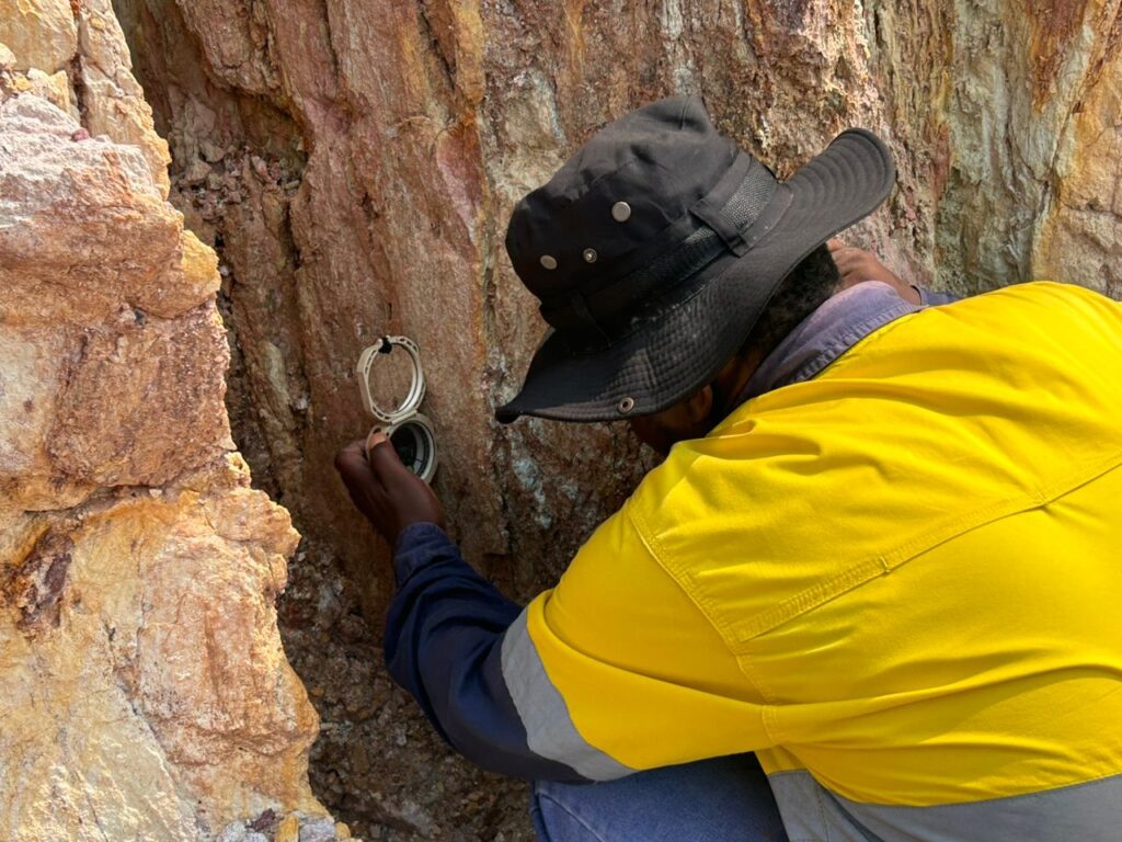
Dip measurement by using a kenometer
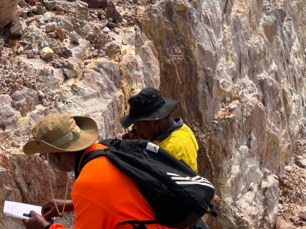
Outcrop lithology description _structural and minerals identification
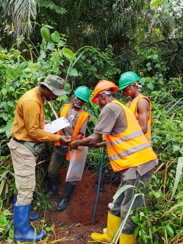
BONJUNJU first stage _ soil sampling and mapping campaign
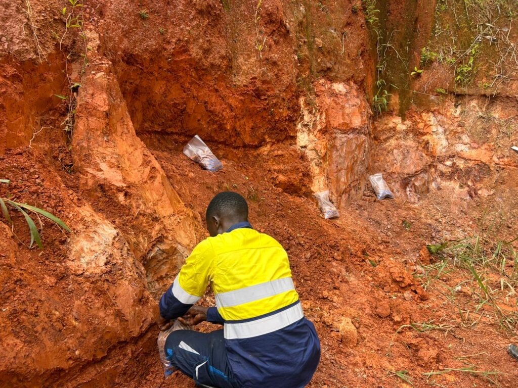
Rock chip and Channel Sampling in BONJUNJU Prospect